Big Pixel
- About
- People
- Projects
- News
- Contact Us
Grounded in the strong University of California research tradition, our projects encompass a range of topics that reflect our goals at the Big Pixel Initiative. Our pilot projects are in the fields of public health, economics and ecology.
"Road Networks and Market Access: A Scalable Approach using Satellite Imagery"
Hogeun Park, Postdoctoral Fellow, GPS
Over the last two decades, India has experienced rapid development of infrastructure. While this trend has been continued, our understanding of the impacts of new infrastructures has not been fully developed yet. In this research, particularly, we focused on addressing “Do roads increase or decrease divergence in economic outcomes within and between urban markets? To address this question, we utilize diverse approaches including Geographical Information System (GIS), Remote Sensing (RS), and econometrics. By synthesizing multiple methods, we re-visited the old question in economic geography.
"Estimating the Economic Impacts of Severe Weather Events"
Hogeun Park, Postdoctoral Fellow, GPS
While
“Detecting the Boundaries of Urban Areas in India: A Dataset for Pixel-Based Image Classification in Google Earth Engine”
Ran Goldblatt, postdoctoral researcher, School of Global Policy and Strategy
With satellite imagery and cloud-based computational platforms, Ran Goldblatt builds maps to confirm that land cover indicates urbanization, across space and time. Beginning with India, Goldblatt has built a new dataset consisting of 21,030 polygons that he manually classified as “built-up” or “not built-up,” and these categories are used for image classification and detection of urban areas. This data is then analyzed in Google Earth Engine, including also boundaries of built-up areas against the intensity of nighttime light. The goal is to geocode a database of all public and private businesses in India to analyze the relationship between industrialization and urbanization.
“Identifying Slums with Satellite Imagery”
Kilian Heilmann Ph.D. candidate, Department of Economics; Diego Vera-Cossio, Ph.D. candidate, Department of Economics; and Wei
Employing high-resolution satellite imagery, Kilian Heilmann, Diego Vera-Cossio and Wei You identify and measure the growth of slums around the world, caused by rapid urbanization in developing countries that pulls millions of migrants into low-quality, informal housing settlements with limited access to public services. Despite widespread study of urbanization, little is known about the extent and the growth of these vibrant urban zones. This project aims to provide researchers with consistent data on urban development over time that allow the study of slums at a global scale and the formulation of policies to alleviate poverty.
“Mining Activity and Spatio-Temporal Dynamics of Forest Cover Loss”
Ran Goldblatt, postdoctoral researcher, School of Global Policy and Strategy; Victoria Xie, Ph.D. candidate, Department of Economics
How did the global commodity boom of the 2000s affect land use and forest management around the world? Because the mines that are the source of these commodities often are in remote locations, little is known about the connection between mineral extraction and the surrounding environment. So far, the relation between mining activities and land cover dynamics has been addressed mostly through local observational analysis. In this project, Global Policy and Strategy researchers employ a spatial and temporal lens, by collecting proprietary data on more than 30,000 mines located around the world and matching the location of these mines to high-resolution satellite imagery from the year 2000 forward. This allows a granular study of the relationship between exploration of different mining commodities and loss of forest cover worldwide, as well as the spatial distribution of global mines in relation to changes in land use patterns, socio-economic variables and other physical attributes.
“Coral Bleaching Quantification from Remote Sensing Imagery”
David Kline, associate project scientist, Scripps Institution of Oceanography (SIO); Robert Frouin, research scientist, SIO; Daniel Conley, Ph.D. candidate, SIO; Gordon Hanson, professor, School of Global Policy and Strategy; Ran Goldblatt, postdoctoral researcher, School of Global Policy and Strategy; Di Dai, research assistant, School of Global Policy and Strategy
David Kline and his colleagues are all eyes—via remote sensing—on what the National Oceanic and Atmospheric Administration recently declared the third large-scale coral bleaching event in recorded history. By use of satellite imagery, the team aims to replace the current, highly labor-intensive monitoring practices with a mapping of shallow reefs from space. The goal is to develop tools to quantify bleaching episodes through remote sensing (i.e., satellite imagery) and then to build detection algorithms that help estimate the extent and severity of bleaching, with hopes to transform coral reef management and conservation.
“Measuring Land Degradation in the Semi-Arid Tropics”
Jennifer Burney, assistant professor, School of Global Policy and Strategy
Using high-resolution satellite imagery and advanced big data analysis tools, Jennifer Burney is turning to the trees to gauge the health of semi-arid ecosystems, which are home to the world’s poorest populations and areas most affected by climate change. Prototyping this assessment tool in Sertão, Brazil, Burney develops tree density maps for a specified region that will then be “ground-truthed” and linked to farm-level management data. The ultimate goal is to use this novel technique across the world’s semi-arid regions to provide high-resolution indicators of overall ecosystem health, and to help identify best locations for joint productivity and conservation interventions.
“Illuminating the Human Dimension of Coral Reef Management”
Stuart Sandin, associate professor, Scripps Institution of Oceanography (SIO); and Jennifer Smith, associate professor, SIO
Stuart Sandin and Jennifer Smith literally are magnifying their multiyear efforts to monitor anthropogenic impacts on coral reefs surrounding 25 islands in the tropical Pacific. A challenge in the study of coral reef ecology across large regions is providing a reliable, consistent depiction of the geographic context of each reef. Through the use of high-resolution satellite imagery, Sandin and Smith will quantify metrics of human activity such as by measuring numbers and types of fishing boats; numbers and locations of boat landings, harbors
“A Top-Down View of Social Media Users”
Lev Manovich, director, Software Studies Initiative (SSI); and Mehrdad Yazdani, data scientist, SSI
Through the lens of high-resolution satellite imagery, Lev Manovich and Mehrdad Yazdani’s research project captures a snapshot of Instagram users on the ground. Their pilot project narrows in on a span of New York City where 10.5 million Instagram images were captured and shared. Factoring in U.S. Census indicators such as average income, education level and race composition aggregated for the same area, the researchers will examine variables relating to the visual and spatial environment around the geographical area. In cross-referencing the data gathered via satellite imagery (i.e., color characteristics and measures of geometric structure and density) with data extracted from the images (i.e., faces in a photo, tag
“Locating (Solar-Powered) Cell Towers”
Orest Bucicovschki, postdoctoral researcher, Department of Mathematics; David Meyer, professor, Department of Mathematics; and Dongjin Song, Ph.D. candidate, Department of Electrical and Computer Engineering
Mobile phone
“Satellite Data for Humanitarian Assistance”
Rex Douglas, postdoctoral researcher, Department of Mathematics; and Asif Shakeel, postdoctoral researcher, Department of Mathematics
Quick and accurate crisis assessment is critical to saving lives and allocating limited disaster response resources in the events of large scale human displacement, often the unexpected and sudden consequence of manmade and natural disasters. Rex Douglas and Asif Shakeel’s research project uses high-resolution satellite imagery to steadfastly identify and track refugee concentrations in both disaster relief and early warning scenarios, specifically detecting temporary shelters in places that are remote or dangerous for ground observers. The researchers also seek to develop and train a classifier for the automatic identification of temporary structures.
“Big Pixel Hackathon”
Gordon Hanson, professor, School of Global Policy and Strategy
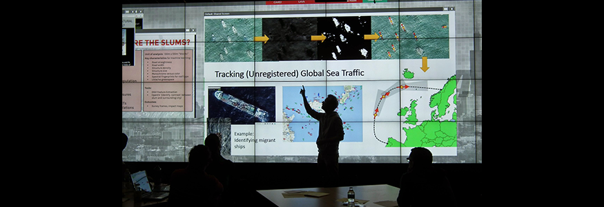
The Center on Global Transformation spearheaded its first-ever hackathon May 23, 2015, giving 35 students unprecedented access to DigitalGlobe Basecamp, the largest private collection of high-resolution satellite imagery on earth that comprises 15 year’s worth of millions of square kilometers of current and archived imagery. Master’s and Ph.D. candidates were tasked with defining an important policy question and then brainstorming how satellite imagery can be used to resolve it. The event gleaned insights into how to measure the growth of urban slums in poor countries and the impact of natural disasters on water quality in cities as well as how to identify illegal fishing in the Caribbean and how to find boats engaged in human trafficking in the Mediterranean.
“Applying Satellite Imagery to Land Degradation, Groundwater Resources and Cityscapes”
Jennifer Burney, assistant professor, School of Global Policy and Strategy
Jennifer Burney has her hands in three research projects incorporating high-resolution satellite imagery. The first closely examines the physical structure of cities in an attempt to understand the actual economies of scale that emerge as cities form and grow. Through this effort, Burney aims to develop a database of several hundred cities as a prototype for this analysis. Burney also is assessing semi-arid ecosystems to develop density maps to be ground-truthed and linked to farm-level management data. Lastly, she seeks to alleviate the cost of geophysical surveys for community-based development of groundwater resources. Launching this project in sub-Saharan Africa, she will use satellite imagery in lieu of ground-based resistive measurements to identify high-likelihood-of-success locations for new borewells.